Holland Township Trails
“A town is saved, not more by the righteous men in it than by the woods and swamps that surround it.” Henry David Thoreau, Walking.
What Thoreau is telling us is that without the natural world, we cannot be our best selves, and we cannot be helpful to our community. Spending time in nature is a way to ground us to the earth and to connect us to one another. We are fortunate in Holland Township to have an abundance of open space to experience, and we are encouraging you to get outside to enjoy it. Here are five trails of varying degrees of difficulty which we are bringing together in this new section of the website. Each has unique features that we hope will draw you in to explore these special places. We look forward to bringing you additional preserves and natural areas to visit in the township in the future.
Holland Township Trail
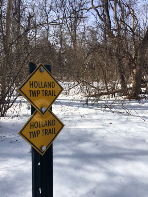
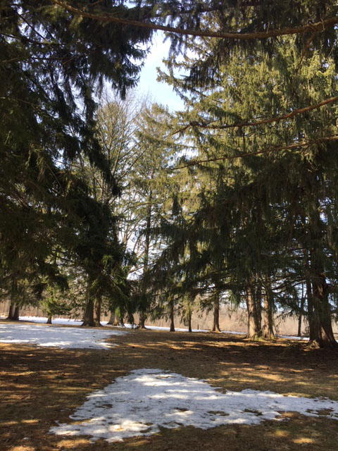
One of Holland Township’s best kept secrets is its recently completed trail and park at Riegel Ridge. The Holland Township Trail is easily accessed on the paved road past the Community Center, bearing left at a Y in the road. There is a kiosk and parking at the trailhead that are easily visible. The 1.25 mile Holland Township trail is an open loop trail located at the wooded perimeter of several grassy fields that roll gently downhill and back around to the top. The terrain is easy to walk on mowed grass. Yellow Trail signage occurs regularly, and there are seven benches along the way with good views of the landscape in the distance. The vistas at the top looking northwest are excellent as they face vast open spaces sweeping toward the Delaware River. There are tree breaks, a stream and birds to watch along the way. The trail is not heavily used, but even when there are other people, one has a spacious feeling of being away from it all in a quiet and pristine place.
Holland Township developed the walking trail in 2019 on 140 acres of land (“Holland Park”) purchased by the Township from the Archdiocese of Metuchen. It was completed with grant support from the Recreational Trails Grant Program of NJDEP/Green Acres and the Association of New Jersey Environmental Commissions, and with the assistance of the Hunterdon County Division of Parks and Recreation. There is no hunting allowed on the Holland Township Trail.
| Brochure | Map | |
|
Holland Township Trail/Musconetcong Mountain Preserve Parking available at Riegel Ridge and Ellis Road |
 |
 |
Musconetcong Mountain Preserve Trail
Midway through the Holland Trail (Yellow Trail) is a connection to the Musconetcong Mountain Preserve Trail (Red Trail) which continues to Ellis Road. It is a Hunterdon County Park Trail of 2.3 miles with an elevation of 275 feet. Its main artery is an original road for a housing development that was thwarted by the 2004 Highlands Act. It was also a farm at one time, and remnants of 190 year old spring houses can be found along the way.
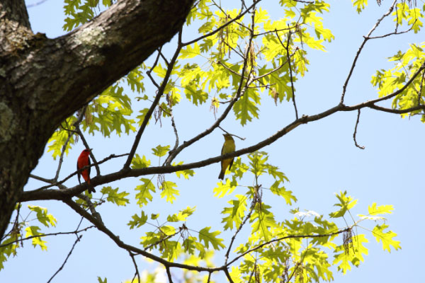
The trails are wide and easy to navigate, and woodland birds, like Northern Cardinals, Gray Catbirds, Baltimore Orioles, and Eastern Towhees populate this forested habitat. For an annotated list of birds that may be seen in the township, please refer to the “Birds of Holland” in the pull-down section of “Community Resources” of the Holland Township Website.
Deer bow hunting is allowed by special permit only. Parking for this trail is on the Ellis Road entrance. Note that the Holland Township Trail and the Musconetcong Mountain Trail interconnect and appear on the same map.
| Brochure | Map | |
|
Musconetcong Mountain Preserve Parking available at Riegel Ridge and Ellis Road |
|
|
Musconetcong Gorge Preserve Trail
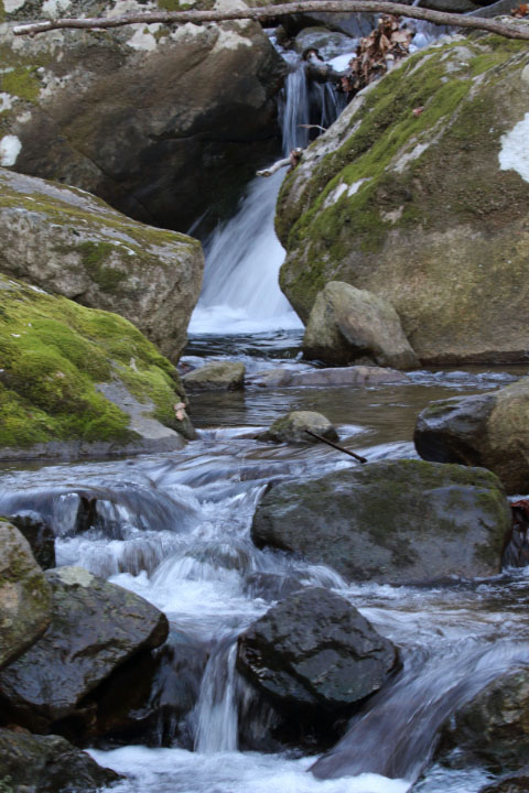
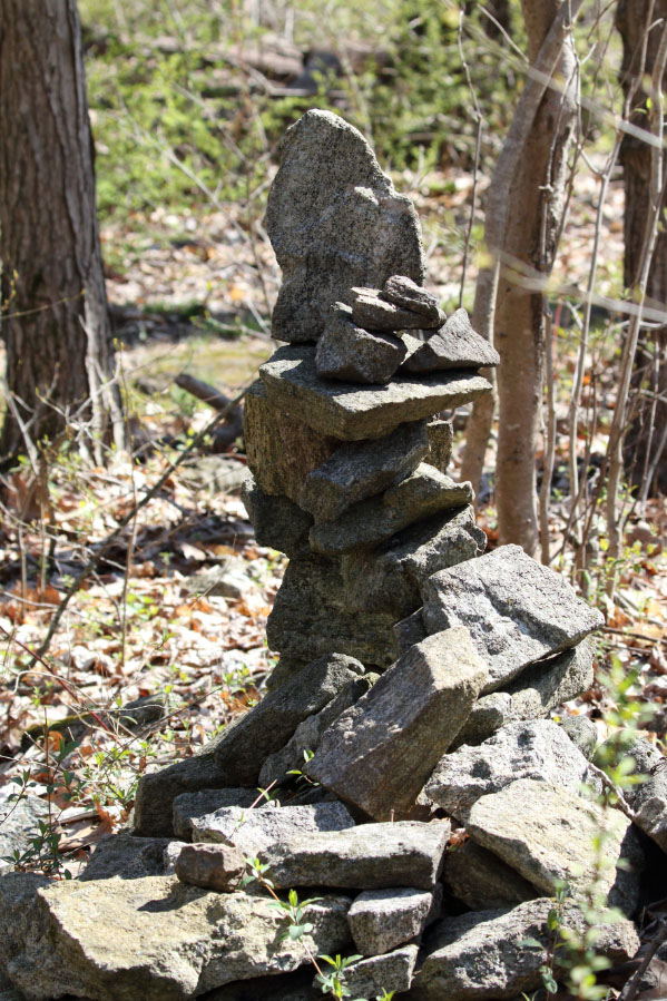
This preserve is located in Holland and Bethlehem Townships. The 4.1 miles of trails at the park are rated as moderate to difficult hiking. There are a number of trails within the ravine which features cascades and waterfalls. The terrain can be steep and rocky with many changes in elevation leading across streams and through the woods. There is a portion of the Ridge/Highlands trail which is challenging as it runs along the ridge of the mountain. Wildlife is abundant: deer, woodpeckers, raptors, turkeys and amphibians. Moss, fern and wildflowers proliferate. Access with parking can be found at Dennis Road. Although parking had been available on Cyphers Road, it is no longer discernible. See preserve brochure for maps and details.
| Brochure | Map | |
|
Musconetcong Gorge Preserve Parking available along Dennis Road |
|
|
Holland Highlands Preserve
Located off Shire Road between Church Road and Andersen Road, the Holland Highlands Preserve consists of 152 acres on both the southern and northern sides of Musconetcong Mountain. Holland Township owns 90 acres, and two tracts from Saeger and Kolonia families have been deeded to Hunterdon Land Trust. There is a long history of several landowners of the properties trying to preserve the mountain in its natural state and to thwart development. The trails wind up steep slopes, around streams and through wetlands and dense forests. Views from the top provide scenic panoramas of farmlands and wooded slopes. It is reported that the stately double row of evergreens at the top, as well as other trees, were planted by the Civilian Conservation Corps during the Depression. The land was farmed up until the mid-1930’s, so the trees may have been planted to hold soil when the fields were abandoned. Nature has reclaimed the mountain, and now the woodlands coexist with trails to bring travelers up and down this lovely preserved terrain.
This three mile network of color-coded trails is available for hiking and non-motorized mountain biking. Some parking is available on Andersen Road next to the Green Acres sign for access to the Blue Trail at the top. Access and parking are also available on Shire Road. After coming off Church Road onto Shire, watch for an unmarked large lot on the right side at the sharp turn. This lot is an access point for JCP&L, and the trail will follow the high-voltage wires for a bit before veering off. Another easy way to enter the trail is to walk on Shire Road 200 yards up the hill. The small lot on the right is cordoned off for parking, but hikers may walk to the trailhead there.
The trails are maintained by the Hunterdon Land Trust (HLT) in cooperation with the Jersey Off-Road Biking Association (JORBA). During hunting season, the Holland Highlands land is used by two hunting clubs.
| Website | Map | |
|
Holland Highlands Preserve Parking available along Shire Road and Andersen Road |
|
|
Milford Bluffs Trail at Thomas F. Breden Preserve
If you have been wondering what the Delaware River looks like from the top of the red sandstone bluffs on River Road, turn north on 519 after you have gone through the town of Milford. In 1.3 miles from the stoplight at the end of town, look for a small gravel opening on the left, and pull into the unmarked road. There are two small Nature Conservancy signs on two poles, and a larger sign at the small parking area. Coming from the north, look for the yellow sign with a car skidding, and the entrance road is just before the sign.
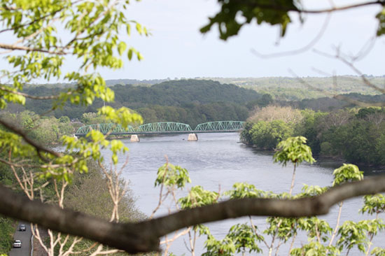
This trail is a delightful combination of woodland, stream, grassy plateau, and scenic views of the river. The 2.3 mile trail begins at the bottom of a moderate hill on an old forest road. Once at the top, the landscape opens to vast farm fields of grassland meadows and goldenrod in season. A narrow footpath leads through the six foot fields of grass which are periodically mowed. There is a trail to the left or right of the fields which also leads to the edge of the bluffs. Although it is a loop trail, a suggestion is to take the left trail to the cliffs and then turn back the same way to avoid overgrown areas and some private property. The river view from the bluffs takes in the Milford Bridge to the south and the many boats that traverse below. The cliffs are the home of a rare Eastern Prickly Pear Cactus, which can be found on some overlooks. The preserve is also a refuge for many grassland and forest birds.
Use extreme caution on the cliff trail around the crumbly shale edges of the bluffs, and take tick repellent for walking through the grasses. The property is managed by the New Jersey Land Trust (202 acres) and the Nature Conservancy (37 acres of cliff trail).
| Website | Map | |
|
Milford Bluffs Parking available up gravel road off Route 519 |
|
|
O’sakame Preserve
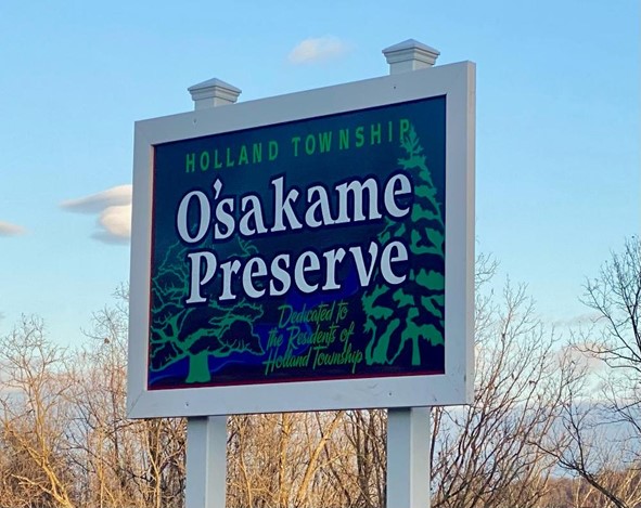
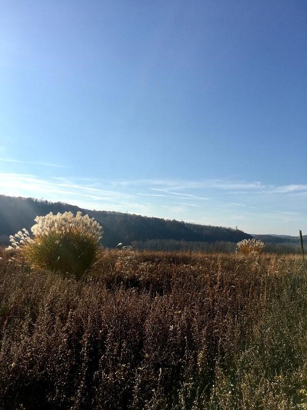
Our newest trail is a delight to the eye, and it reflects that which the township is famous for: hills and valleys, the Delaware River, open country, and lovely sunsets. The Holland Township Committee and Hunterdon County worked with Hunterdon Land Trust to procure this seventy-acre property off the Riegelsville-Milford Road from GenOn, formerly Gilbert Generating Station. The new O’sakame Preserve is just past the plant, and the sign is visible from the road. As you pull into the parking lot, you will notice a garden of native plants below the sign that was planted by Junior Girl Scout Troop 80309. They also selected the name for the preserve that honored the Lenapes, who once inhabited the area. “O’sakame” was chosen, the Lenape word for “across the river.”
You should pause for a view of the great expanse before you and the bluffs across the Pennsylvania side before you begin. Watch for bald eagles soaring across and Peregrine Falcons which nest nearby. Northern Harriers and Common Ravens also occur as well as migrant songbirds.
A loop trail of approximately three-quarters of a mile has been hewn around the perimeter of the preserve. Walk across the top of the property under the row of oak trees before heading downhill towards the river. It is easier to go downhill on the far side of the lot and to come back up on the parking lot side. It is a fairly easy, wide, roughly mown trail with moderately steep inclines on either side. At certain times of the year, the undergrowth of vines is difficult to manage. At the bottom, the path parallels the railroad tracks before it loops back up. There is fencing at the bottom beyond which you should not trespass. Look for three trees along the trail and in the parking lot that have been identified with signs and QR codes on the property, Northern Hackberry, Black Cherry and Silver Maple. You can look forward to two benches and a kiosk with interpretive history that will soon be placed on the trail. Wear orange or yellow blaze outer gear during hunting season.
| Website | Map | |
|
O’sakame Preserve Upon entering, parking is past the sign to the left |
n/a | |
Article was written by Regina Barna
Pictures were taken by Regina Harrison
For additional Trail information within Hunterdon County http://www.co.hunterdon.nj.us/depts/parks/guides/parkareas.htm